|
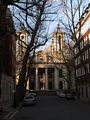
Location of St John's Smith Square
Other links to St John's Smith Square
Restaurants in the area
Cinnamon Club, The (distance = 279 m bearing 312°)
, Quirinale (distance = 360 m bearing 326°)
Local Pubs
Speaker (distance = 385 m bearing 324°)
Nearby sights
Lambeth Palace (distance = 459 m bearing 56°)
, Millbank Tower (distance = 429 m bearing 122°)
, Thames House Millbank (distance = 240 m bearing 125°)
, Methodist Central Hall (distance = 499 m bearing 306°)
, St Margret's Westminister (distance = 436 m bearing 31°)
, Westminster Abbey (distance = 367 m bearing 301°)
, Boris Bus (distance = 481 m bearing 147°)
, Jewel Tower (distance = 281 m bearing 32°)
, Parliament, The Houses of (distance = 460 m bearing 34°)
, Westminster Hall - Parliament (distance = 466 m bearing 33°)
, Burghers of Calais (distance = 235 m bearing 42°)
, Charles 1 - Westminister Hall (distance = 470 m bearing 33°)
, Cromwell, Oliver - Lord Protector (distance = 465 m bearing 32°)
, More, Sir Thomas More (distance = 453 m bearing 33°)
, Pankhurst, Emmeline and Christabel (distance = 244 m bearing 37°)
, Cowley Street (distance = 149 m bearing 302°)
, Deans Yard/Westminister School (distance = 287 m bearing 303°)
, Page Street (distance = 244 m bearing 211°)
, Smith Square (distance = 25 m bearing 213°)
, St John's Gardens (distance = 184 m bearing 214°)
, Thorney Street (distance = 327 m bearing 122°)
, Vicoria Tower Gardens (distance = 186 m bearing 50°)
, Lambeth Bridge (distance = 331 m bearing 141°)
, Thames - Lambeth Reach (distance = 349 m bearing 51°)
, Millbank Peir (distance = 469 m bearing 124°)
Nearby Neighbours (Plaques)
Bracken, Brendan - Member of Parliament (1901-1958) (distance = 43 m bearing 31°)
, Buxton Memorial Drinking Fountain (distance = 163 m bearing 57°)
, Eden, Anthony - Prime Minister (distance = 43 m bearing 31°)
, LAWRENCE, T.E. (1888-1935), (distance = 156 m bearing 305°)
, RATHBONE, Eleanor (1872-1946), (distance = 136 m bearing 219°)
, REITH, Lord (1889-1971), (distance = 151 m bearing 305°)
, Wilson, Harold - Prime Minister (distance = 43 m bearing 31°)
Notorious sights in the area
Charles 1 - Trail (distance = 468 m bearing 33°)
, Church House - Back up Parliament (distance = 266 m bearing 310°)
, Da Vinci Code - Westminister Abbey (distance = 370 m bearing 301°)
, Execution Site - Old Palace Yard (distance = 376 m bearing 33°)
, Houses of Parliament Bomb (distance = 463 m bearing 32°)
, Mosley, Sir Oswald (distance = 66 m bearing 139°)
, Percival, Spencer Prime Minister - Assassination (distance = 461 m bearing 34°)
, Stocks and Pillory (distance = 376 m bearing 33°)
, Westminister Hall - Bomb (distance = 438 m bearing 33°)
General Links Local Map
Map of what is in the area - using Google map
|